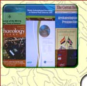
Publications & Presentations
LGS has been involved with
many exciting geological and geophysical discoveries and regard
publication and presentation of results as an important part of many
projects carried out. We have published or assisted with the
presentation of results in books, journals,
magazines, field guides, websites, on video, in
radio & TV programmes and at workshops & conferences. We are keen to collaborate in jointly publishing and presenting the
results of commissioned projects.
Please see the following for a complete list of
publications and presentations:
Players for the Drivetime audio clip include: QuickTime, RealPlayer,
Windows Media Player and VLC Media Player
Selected
types of publication and content, illustrating the range
of projects
we have contributed
to, are shown
below:
|
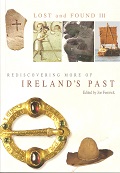
Barton, K. and Murphy, C. 2018. The Case of the Stony Silence. in Fenwick, J. (ed.) Lost and Found III: Rediscovering Ireland's Past, 11-16. Wordwell: Bray. |
|
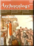
Curley, D., Flynn, J. and Barton, K.
2018. Bouncing Beams Reveal Hidden Archaeology, Archaeology Ireland ,
32 (2), 24-29. Wordwell : Bray. |
|
Barton, K. and Curley, D. 2017. Archaeological Remote Sensing; some Community Engagement in Ireland. in Ciolfi, L., Damala, A., Hornecker, E., Lechner, M. and Maye, L.
(eds.), Cultural Heritage Communities: Technology and Challenges, 20-37. Routledge: London. |
|
Barton, K. and Flynn, J. 2016. Community Archaeological Remote Sensing. in National Heritage Week Interview for RTE Drive Time programme. Transmitted 26th August 2016, 5.45 minutes, RTE Radio 1.
|
|
Barton, K. 2015. Above and
below: Community engagement in remote sensing in Ireland.
in A. G.
Posluschny (ed), Sensing the Past; contributions from the ArcLand Conference on Remote Sensing for Archaeology,96-97. Habelt-Verlag:
Bonn. |
|
Brady, C. and Barton, K.
2014. Lasers, Cameras, Action! Archaeology Ireland ,
28 (1), 39-42. Wordwell : Bray. |
|
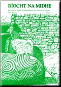
Brady, C., Barton, K.
and Seaver, M. 2013. Recent geophysical investigations and
LiDAR analysis at the Hill of Slane, Co. Meath. Ríocht na
Mídhe, XXIV, 134-155. Records of Meath
Archaeological and Historical Society. ISSN 0461-5050. |
|
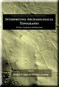
Davis, S., Brady, C., Megarry, W. and
Barton, K. 2013. Lidar survey in the Brú
na Bóinne World Heritage Site in Opitz, R. and Cowley, D.
(eds) Interpreting Archaeological Topography, 18,
225-239. Oxbow Books : Oxford. |
|
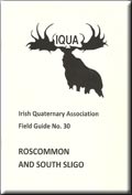
Barton,
K., 2012. Application of some
remote sensing techniques in the exploration and interpretation of
Rathcroghan Mound and its environs, Tulsk, Co. Roscommon in B.
Stefanini & G. McGlynn (eds.) Roscommon and South Sligo; Field
Guide 30, 40-46. Irish Quaternary Association : Dublin.
ISBN:978-0-947920-46-3. |
|
Barton,
K., Pašteka, R., Zahorec,
P.,
Papco, J. & Brady, C.
2011. In search of hidden chambers at Newgrange Passage Tomb.
Archaeology Ireland, 25 (4), 11-12.
Wordwell : Bray. |
|
Barton, K., Brady, C. and Seaver, M. 2011.
Some Geophysical Survey Methodologies for Archaeological Research
in the Brú na Bóinne World Heritage Site, County Meath,
Ireland. 'Near Surface 2011' 17th European Meeting of
Environmental and Engineering Geophysics, European Association of
Geoscientists and Engineers, University of Leicester, England, 13th
September 2011. Conference Proceedings & Exhibitors Catalogue. D11.
CD-ROM, ISBN 978-90-73834-15-6. EAGE : Houten. |
|
Barton, K. 2010. Geophysical
Investigations in S. Davis, W. Megarry, C. Brady, H. Lewis, T.
Cummins, L. Guinan, J. Turner, C. Gallagher, T. Brown and R.Meehan.
Boyne Valley Landscapes Project: Phase III Final Report 2010.
Heritage Council, Irish National Strategic Archaeological Research
(INSTAR) Programme 2010, 91-129. Unpublished |
|
Brockman, A. and Barton, K. 2009. Air
Photographs, Military Archaeology and Human Memory: A Case Study from
South East London in B Stichelbaut, J Bourgeois, N Saunders
& P Chielens (eds.). Images of Conflict: Military Aerial
Photography & Archaeology, 221-240. Cambridge Scholars Publishing
: Newcastle.
|
|
Barton,
K., Stenvik, L. & Birgisdottir, B. 2009. A
Chieftain"s Hall or a Grave: Ground Penetrating Radar in an
Archaeological Geophysics Survey to Target the Excavation of a
Cropmark near Stiklestad, Nord-Trondelag, Norway in R.
Gómez Martin, A. Rubio Bretones, S.G. Garcia, M.
Fernández Pantoja & C.M. de Jong van Coevorden (eds.)
Proceedings of the 5th International Workshop on Advanced Ground
Penetrating Radar IWAGPR2009, 27th - 29th May 2009, University of
Granada, Granada, Spain, 159-164. ISBN : 978-84-692-2661-2. |
|
Barton, K., Bonsall, J & Gimson, H. 2009.
Secrets of the Stones : God"s Architects. Contributors and
participants on archaeological geophysical surveys at Clonmacnoise in
a documentary in RTE Factual Series. Transmitted 4th May 2009. 52
minutes, RTE, Cork. |
|
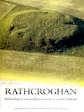
Waddell, J., Fenwick, J. & Barton, K. 2009.
Rathcroghan, Co. Roscommon: Archaeological and Geophysical Survey
in a Ritual Landscape. Wordwell : Bray |
|
Barton, K., Bonsall, J. &
Gimson, H. 2007. The role of
archaeological geophysics in
development-led housing, road and tourism
projects in Ireland. Securing the
Future : 69th European Association of
Geologists and Engineers Conference and
Exhibition, 11-14 June 2007, ExCeL,
London. Extended Abstracts &
Exhibitors' Catalogue, P105. CD-ROM, ISBN
978-90-73781-54-2
|
|
Barton. K. 2006.
Topographical
and Geophysical Surveys at
Tankardstown
Mine, Bunmahon, County
Waterford.
Journal of the Mining
Heritage Trust of
Ireland, 5, 2005,
15-22. MHTI :
Dublin.
|
|
Barton, K. and Fenwick, J. 2005.
Geophysical investigations at the ancient
royal site of Rathcroghan, County
Roscommon, Ireland. Archaeological
Prospection, 12, 1-16.Wiley.
|
|
Parsons, A., Barton, K., Berry,
A., Brown, C., Curtis, J., Emblow, C.,
Hartnett, M., Nash, S. & Rooney, S.
2004. Feasibility Study on the
Establishment of a Large Scale Inshore
Resource Mapping Project, NDP Marine
RTDI Desk Study Series DK/01/007, 224pp.
Marine Institute : Galway.
|
|
Barton, K.J. 2003. Geophysical
survey in B Lalor (ed.) The
Encyclopedia of Ireland, 435. Gill
& Macmillan : Dublin.
|
|
Barton, K.J. 2003. Geophysics in archaeology. in Techniques and Practices in Mineral Exploration in Ireland. Course notes for student weekend course in Applied Geophysics, Petersburg Centre, Clonbur, Co Galway, 111-116.Irish Association for Economic Geology and Geophysical Association of Ireland. Unpublished |
|
Barton, K.J. 2002.
Terrestrial and waterborne geophysical
survey for road schemes in J
O'Sullivan (ed.) Archaeology and the
National Roads Authority; Proceedings of
two seminars in 2002 on provisions for
archaeological work within the national
roads programme. Monograph series No 1,
69-80. National Roads Authority :
Dublin.
|
|
Quinn, R., Rooney, S., Barton,
K., O'Hara, D. and Sheehan, K. 2001.
An integrated marine geophysical
investigation of the La Surveillante
wreck-site in C Breen (ed.) Integrated
Marine Investigations on the Historic
Shipwreck La Surveillante, Centre for
Maritime Archaeology Monograph Series No
1, 45-53. University of Ulster :
Coleraine.
|
|
|
Brett, J. and Barton, K. 2000.
Mayo through the Millennia; Landscape,
Archaeology and History. Conference
website. www.mayoheritage.com
|
|
Fenwick, J., Brennan, Y., Barton,
K. and Waddell, J. 1999. The magnetic
presence of Queen Maeve. Archaeology
Ireland, Vol. 13 (1), 8-11. Wordwell :
Bray.
|
|
Brett, J., Barton. K. &
McLoughlin, C. 1998. Mayo Abbey;
Building a Future from the Past.
Co-script writer and participant. PAL
Video, 24 minutes. Ward Clements & Co
Ltd, Glasgow.
|
|
Barton, K.J. and Molloy, K. (eds.). 1998. South Central Mayo. Field Guide 22 , 73pp. Irish Association for Quaternary Studies: Dublin. |
|
Slater, L., Kulessa, B. and Barton, K. 1996. An investigation into the ability of geophysical methods to detect and define Fulachta Fia (burnt mounds) on Clare Island, Co Mayo, Ireland. Archaeological Prospection,3, 53-96. Wiley.
|
|
Waddell, J. and Barton, K. 1995. Seeing beneath Rathcroghan. Archaeology Ireland, 9 (1), 38-41. Wordwell : Bray. |
|
Barton, K.J. and Kulessa, B. 1994. Geophysical images of a fulachta fia at Capnagower, Clare Island. in P. Coxon and M. OConnell (eds.). Clare Island and Inishbofin Field Guide 17 , 39-42. Irish Association for Quaternary Studies: Dublin |
|
Woodham, C. R. and Barton, K. 1992. Developments in regional and reconnaissance geophysical techniques in exploration with reference to the Irish midlands. in A. A. Bowden, G. Earls, P.G. OConnor and J. C. Pyne
(eds.). The Irish Minerals Industry 1980-1990, 369-382. Irish Association for Economic Geology : Dublin. |
|
Cahill, M. and Barton, K.J. 1990. A detailed resistivity survey to map subsurface features in the vicinity of Kilnamanagh/Abbeytown cemetery in J Higgins & A McHugh (eds.) The White Cannons, Abbeytown, Cill-Na-Managh; a history of the monastery of the White Cannons and other historical places in the district of Maigh Seola, Environment and Heritage Monographs, 2. Crow's Rock Press: Galway. |
Contact Details
Landscape and Geophysical Services
Convent Road
Claremorris
County Mayo
Ireland

|

|
| Archaeological Geophysical Surveys
| Geological Surveys
| Environmental Surveys
| Research & Development
| Publications & Presentations
| Education & Training
| Project Management |
|