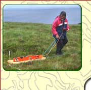
Archaeological Geophysics
Airborne LiDAR
One of the simplest techniques used in archaeological assessment is detailed topographic mapping; 'bumps and humps' in the ground surface can be due to buried archaeological features. Traditionally topographic mapping has been carried out using ground-based survey instruments such as engineer's levels and total stations. These instruments provide accurate data but are slow to operate and ground coverage takes considerable time. Latterly topographic surveys have been carried out using survey grade global positioning systems (GPS) which have increased ground area that can be covered on a daily basis.
In recent years topographic surveys at monument and landscape scales, their analysis and interpretation have been revolutionized with the advent of LiDAR and in particular Airborne LiDAR Scanning (ALS)
LiDAR is an acronym for Light Detection and Ranging. In airborne mode LiDAR describes the technique of firing laser pulses in a beam or swath of beams from an aircraft towards the ground and measuring the time taken for the complex pattern of reflected echoes from ground points or features to return to sensors in the aircraft. If the position of the LiDAR sensors is accurately known using precision GPS then the location and height of the points or features on the ground can be determined to an accuracy of 10 to 15 cm or better.
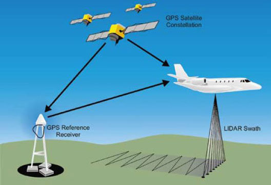
Principles of LiDAR (after Holden, 2002)
Depending on the nature of the survey area, the determination of the location and height requires complex data processing procedures which must take into account multiple echoes from objects such as buildings, trees, foliage etc. Analysis of the echoes results in the creation of several types of models of the ground surface with a Digital Elevation Model (DEM) being commonly used in archaeological assessments. The DEM is also called a 'bare ground model' as it represents the ground surface without any objects such as plants or buildings. DEM data can be computer-processed to visualize the topography of landscapes and archaeological and geological features that lie within them.
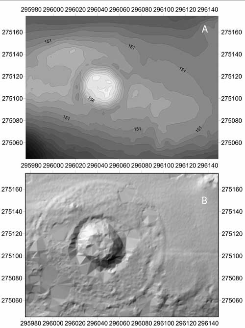 LiDAR DEM Data from the Hill of Slane, Co Meath showing the Motte, surrounding Ditch, Outer Enclosure and adjacent Low Mound to the southeast; A - Shaded Topographic Contour Map, B - Shaded Relief visualisation of the Topographic Map (Data Source : Ordnance Survey Ireland) [after Brady et al. 2013]
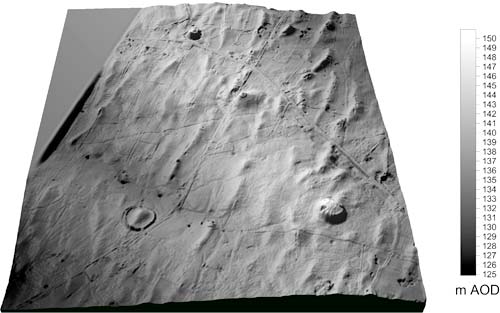 LiDAR 3D Shaded Relief Digital Elevation Model of part of the Rathcroghan Complex, Co Roscommon (Data source : Ordnance Survey of Ireland)
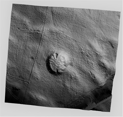
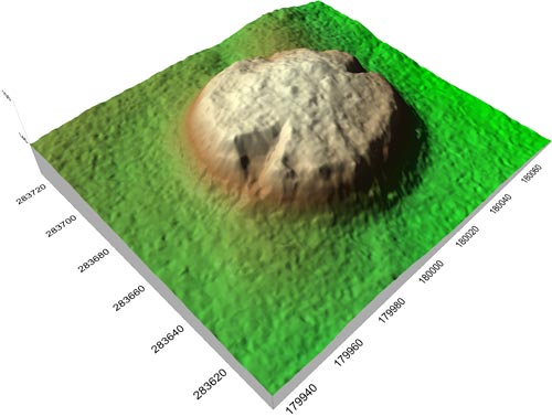 LiDAR 3D Shaded Relief Digital Elevation Model of Rathcroghan Mound, Co Roscommon (Data Source : Ordnance Survey Ireland)
 LiDAR Shaded Relief Digital Elevation Model of Rathcroghan Mound and Outer Enclosure,
Co Roscommon (Data Source : Ordnance Survey Ireland).
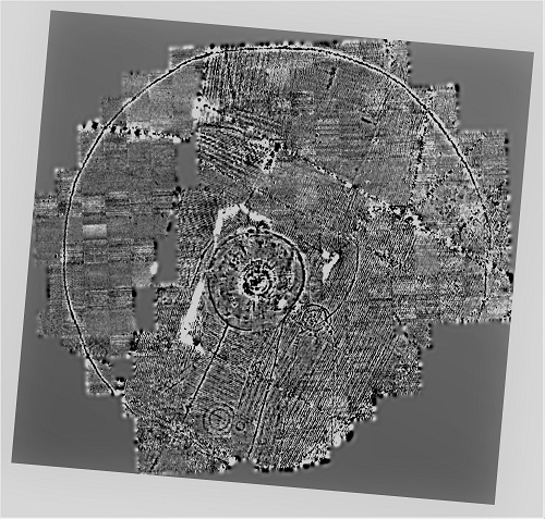 Magnetic Gradiometry Image of Rathcroghan Mound and Outer Enclosure, Co Roscommon [after Waddell et.al., 2009].
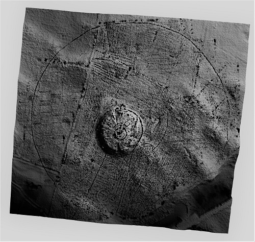 Magnetic Gradiometry Image draped on the LiDAR Shaded Relief Digital Elevation Model [adapted from Barton and Curley, 2017].
References
Barton, K. and Curley, D. 2017. Archaeological Remote Sensing; some Community Engagement in Ireland, in Ciolfi, L., Damala, A., Hornecker, E., Lechner, M. and Maye, L. (eds.), Cultural Heritage Communities: Technology and Challenges, 20-37. Routledge: London.
Brady, C., Barton, K. and Seaver, M. 2013. Recent geophysical investigations and LiDAR analysis at the Hill of Slane, Co. Meath. Riocht na Midhe, XXIV, 134-155. Records of Meath Archaeological and Historical Society. ISSN 0461-5050.
Holden, N, Horne, P and Bewley, R H 2002 High-resolution digital airborne mapping and archaeology, in R Bewley and W Raczkowski (eds) Aerial Archaeology: Developing Future Practice 173-80
Waddell, J., Fenwick, J. and Barton, K. 2009. Rathcroghan, Co. Roscommon: Archaeological and Geophysical Survey in a Ritual Landscape. Wordwell : Bray.
Archaeological Geophysics
Techniques
| Airborne LiDAR
| Magnetic Susceptibility
| Magnetic Gradiometry
| Earth Resistance
| Electrical Resistivity Tomography (ERT)
| Ground Penetrating Radar (GPR)
| Metal Detection
| Electromagnetic Methods |
Contact Details
Landscape and Geophysical Services
Convent Road
Claremorris
County Mayo
Ireland

|

|
| Archaeological Geophysical Surveys
| Geological Surveys
| Environmental Surveys
| Research & Development
| Publications & Presentations
| Education & Training
| Project Management |
|