


![]()
![]()
![]()
![]()
![]()
![]()
![]()
![]()
![]()


Archaeological Geophysics
|
|
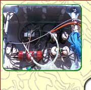
This detailed technique is often used to complement magnetic gradiometry surveys or, depending on the project objectives and nature of the survey area, as a survey method in its own right. An earth resistance survey measures variations in the electrical resistance of the ground using an array of stainless steel electrodes. The pattern of resistance variation indicates variations in the sub-soil due to its moisture retention and/or mineral properties. This variation can be interpreted to indicate the presence or absence of sub-archaeological surface features. The technique can be deployed using fixed-spacing, hand-portable or cart-mounted electrode arrays depending on the nature of the survey area. The depth of investigation is largely dependent on the electrode spacing and the nature of the soils and can be up to 1.5m depending on the type of electrode array used. |
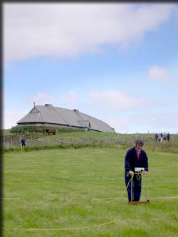 Twin-probe earth resistance meter (Photo: Lars Andresen) |
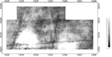 |
Earth resistance survey results showing high resistance responses from the sub-surface remains of two nineteenth century cottiers dwellings and a network of low resistance linear responses relating to field drains. (after Barton and Orser, 1998) |
Archaeological Geophysics
Techniques
| Airborne LiDAR
| Magnetic Susceptibility
| Magnetic Gradiometry
| Earth Resistance
| Electrical Resistivity Tomography (ERT)
| Ground Penetrating Radar (GPR)
| Metal Detection
| Electromagnetic Methods |
Contact DetailsLandscape and Geophysical Services |
|