


![]()
![]()
![]()
![]()
![]()
![]()
![]()
![]()
![]()


Archaeological Geophysics
|
The ERT technique provides a two-dimensional depth section or modelled pseudosection across a survey area or feature as opposed to a map which is produced by an earth resistance survey. The technique can be used to estimate the dimensions and nature of sub-surface targets such as the soil/bedrock interface, strata thickness, depth to and width of walls and ditches. The technique differs from the earth resistance method in that the depth of investigation is largely controlled by using a variable electrode spacing. The survey is controlled by a computer which sequentially increases the electrode spacing thus allowing for successively deeper sub-surface levels to be investigated. |
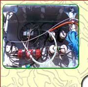
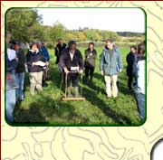
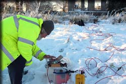 Electrical resistivity tomography (ERT) survey with 1m electrode spacing. (Photo: Igor Murin) |
Depending on the spatial resolution required, sequentially increased electrode spacings of multiples of 0.5 to 5m can produce modelled depth sections from 1.5 to 20m respectively.
The technique is used in archaeological investigations to detect:
- Ditches
- Walls
- Geological structures and features
- Palaeochannels
- Internal structures in mounds
- Cavities / Voids / Caves in geological and archaeological features
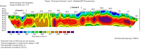
Modelled ERT pseudosection with draped topography showing low resistivity
ditches targeted for excavation. (after Barton and Brady, 2010)
Archaeological Geophysics
Techniques
| Airborne LiDAR
| Magnetic Susceptibility
| Magnetic Gradiometry
| Earth Resistance
| Electrical Resistivity Tomography (ERT)
| Ground Penetrating Radar (GPR)
| Metal Detection
| Electromagnetic Methods |
Contact DetailsLandscape and Geophysical Services |
|